
About
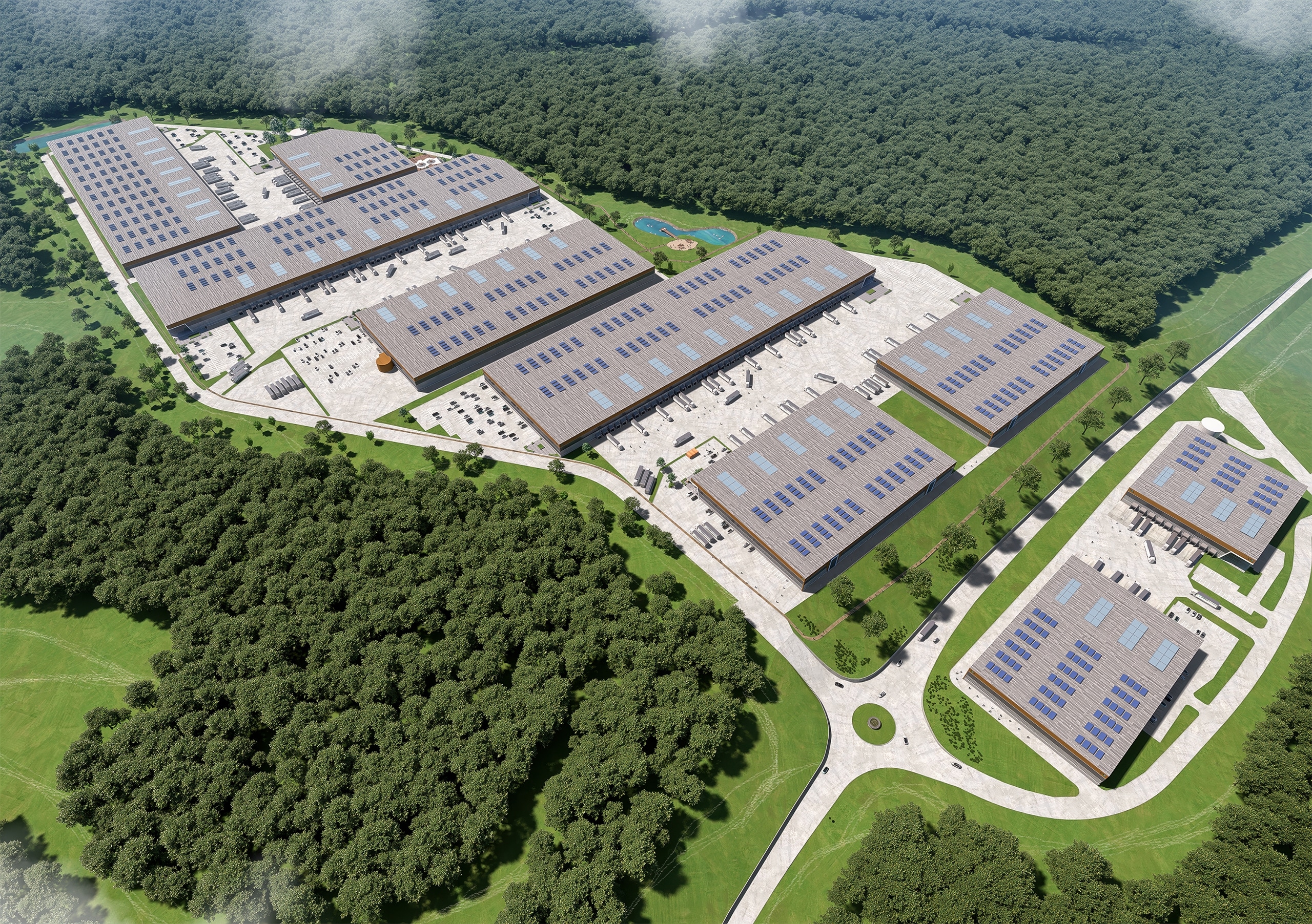
Prologis Parklife is a large-scale development in Bråta, Sweden, spanning approximately 45 hectares with capacity for up to 250,000 m² of building space. Communicating a project at this scale means making the complete development understandable while retaining the architecture, landscape and human environments that give individual parts of it their identity.
Frame+View visualized the project across that full range of scales. Wide aerials establish the organization and relationships between multiple buildings, infrastructure, circulation and landscape. Closer views move into the Parklife environment itself, bringing architecture, arrival, outdoor recreation and everyday human experience into focus.
details
Client: Prologis
Year: 2024
Scale: 45-hectare development / up to 250,000 m² building space
Type: Large-Scale Development / Urban Design / Landscape Design
Services: 3D Modeling, Exterior Visualization, Environmental Visualization
From 45 Hectares to Human Scale
A large development has to be understood at more than one scale. Across approximately 45 hectares, individual buildings form part of a much larger system of architecture, infrastructure, circulation and landscape. The high aerial makes that complete structure visible in a single image, establishing the extent of the development before the visual story moves into it.
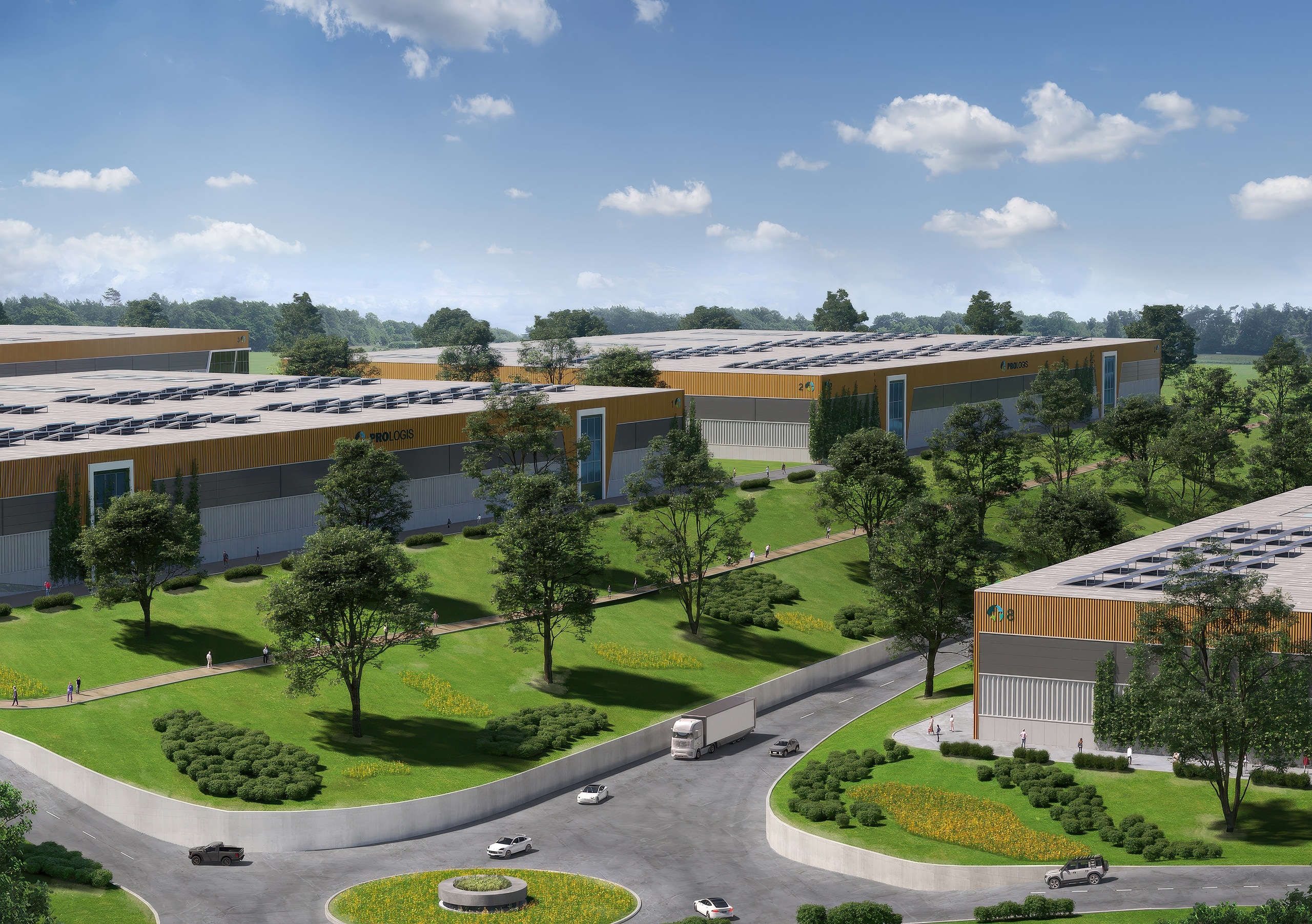
Moving closer reveals relationships that the complete overview can only introduce. Multiple buildings remain visible, but their architecture, access routes, roofscapes, pedestrian connections and landscape can now be read in greater detail. This intermediate scale is important: it connects an understanding of the complete development with the individual environments within it.
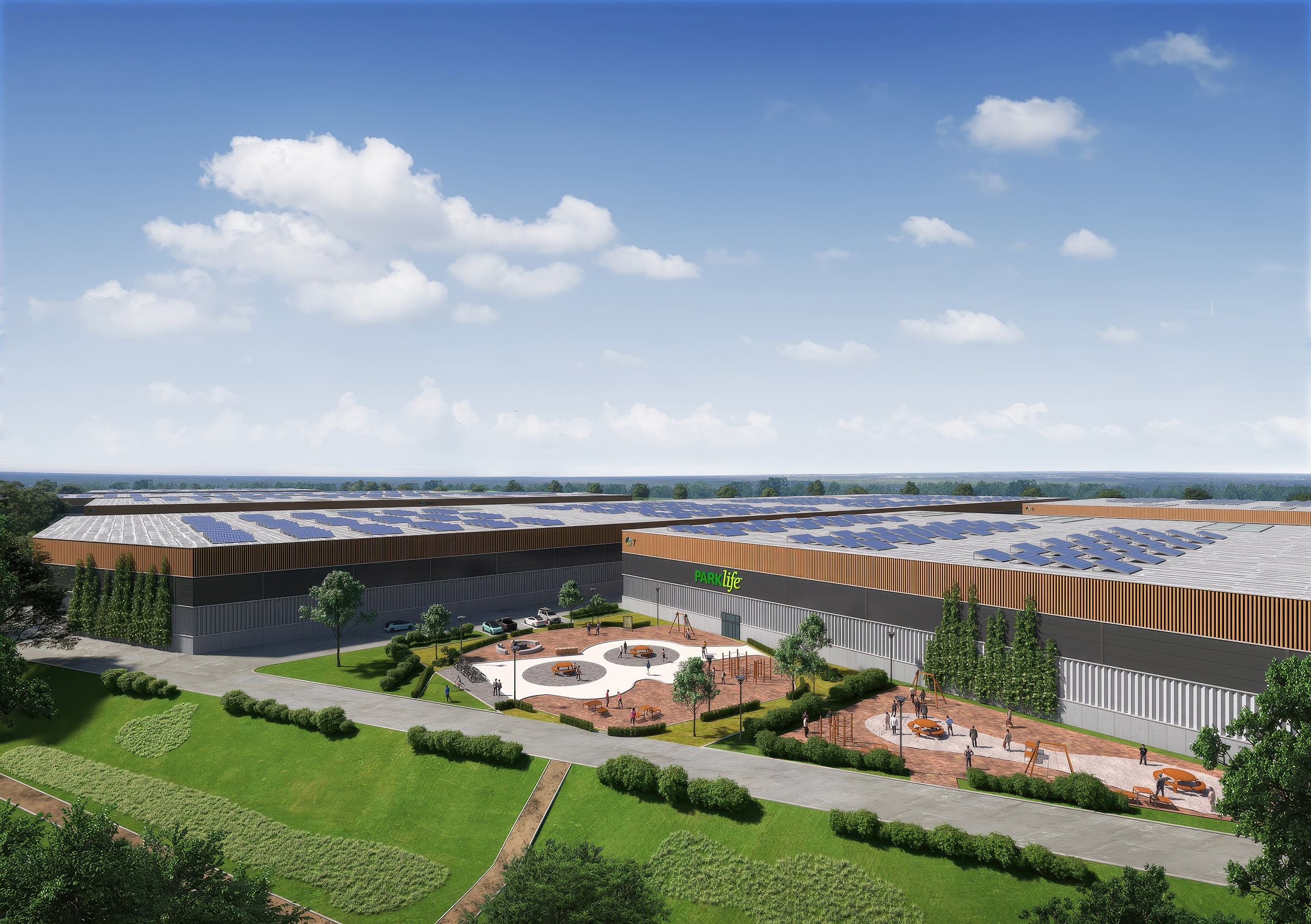
Closer again, the emphasis shifts from development structure to the relationship between architecture and its immediate surroundings. Landscape, pedestrian activity and outdoor recreation become clearly visible alongside the logistics building. The image communicates the Parklife dimension at architectural scale without losing its connection to the much larger development.
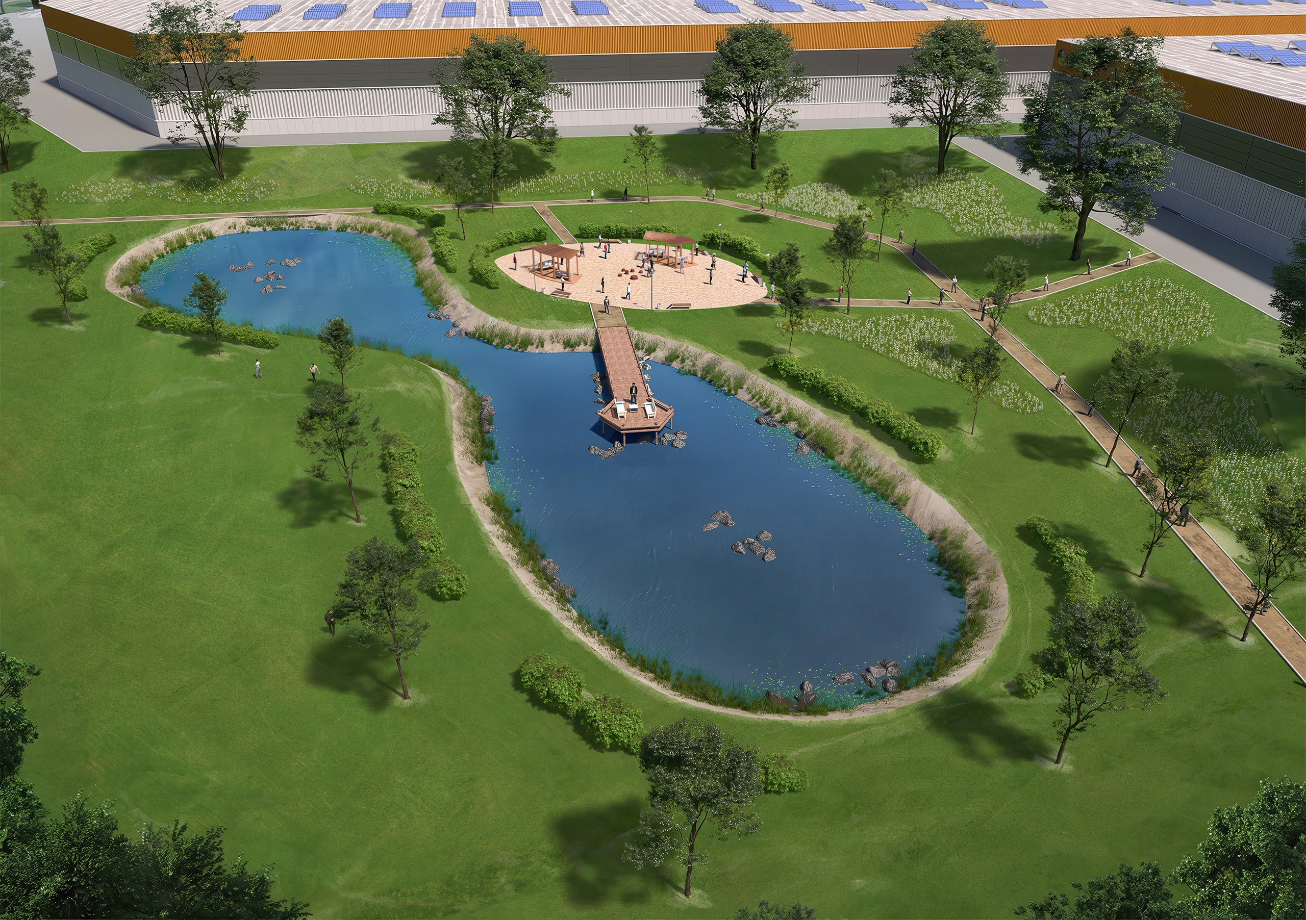
Landscape requires a different kind of image. Here, the pond, planting, paths and recreation areas become the primary visual information, while the logistics architecture recedes into context. What appeared as landscape within the aerial views can now be understood as a designed environment with its own scale, spaces and uses.
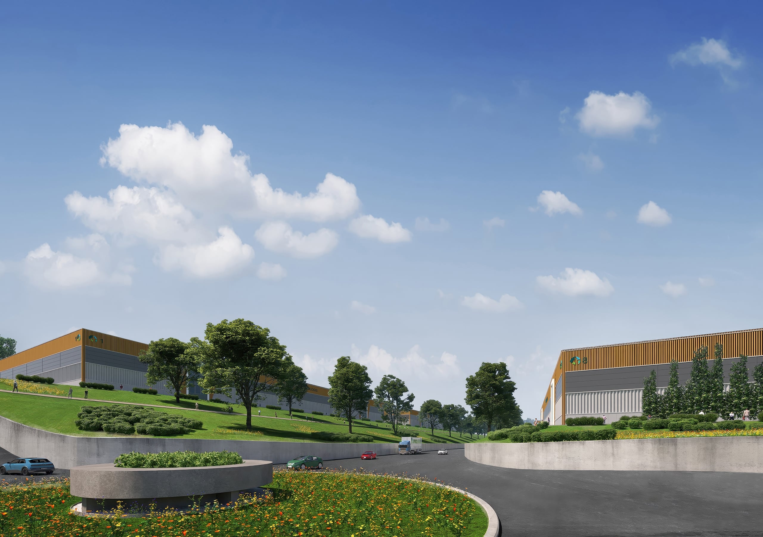
At ground level, almost none of the 45-hectare development can be seen at once. The image therefore communicates something the aerials cannot: how the site is experienced from within. Buildings appear through landscape and along circulation routes, translating development-scale relationships into a recognizable sense of movement and arrival.
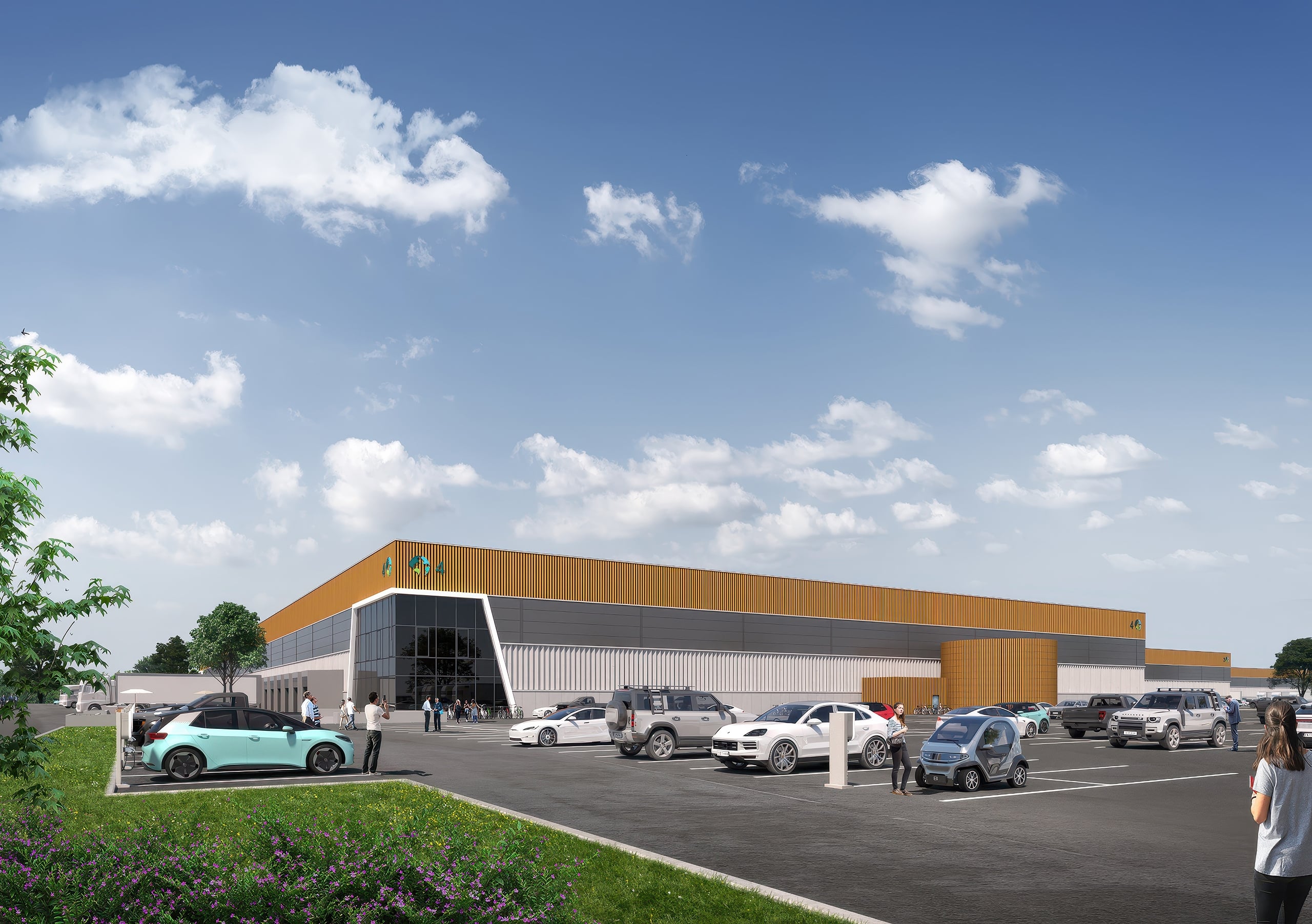
The final image brings the visual story down to an individual building and the people immediately around it. Architecture, entrance, planting and human activity can now be understood at the scale of a direct encounter. Across the complete series, the imagery moves from making 45 hectares legible as one development to making an individual moment within it tangible.
Like what you see?
Let’s talk about how we can bring your vision to life.